Duck River Dam Project skyrockets to $110 million; up $40 million from original estimate
Published 9:15 am Sunday, September 22, 2013
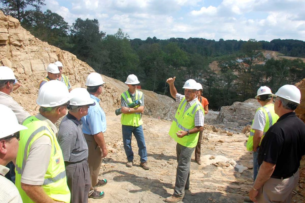
- Cullman officials and engineers recently visited the site of the Duck River dam in northeast Cullman County, which is currently in the excavation phase.
The price of the Duck River Dam is going up, and water rates along with it.
City officials spent the summer anxiously waiting to find out how much the Duck River Dam would cost, after some additional excavation earlier this year proved the site was less suitable than anticipated for construction.
Following a full-scale engineering study over the past several months, the cost of the project is expected to jump from $70 million to approximately $110 million — a $40 million and 57 percent increase to build the reworked design.
Officials received the details of the engineering study earlier this week, and the findings will be formally announced at a utilities board meeting on Tuesday. Overall, the dam design will still have a roller-compacted concrete spillway in the center, with earthen dam sides on the east and west banks, though some engineering specifics have been greatly adjusted to fit the site.
When asked if the dam might be scrapped because of the cost increase, Cullman Mayor Max Townson said he still believes it is in the best interest of the community — even with the higher price tag. More than $20 million has already been spent on the project, and the board still has approximately $28 million in the bank from the initial bond. The next few phases will be funded with a new, approximately $60 million bond.
“We’re past the point of no return, and we’ve come too far at this point,” he said. “This is still something we need for future generations, and it’s amazing to me how quickly people can forget the drought we had just in 2007, and 1999 before that. We’re obviously not happy about what we’ve found out, but we still need this reservoir as an insurance policy for our future.”
Engineers have also spent the past several months trying to find ways to “value engineer” the design and bring down the higher costs, though engineers say the $110 million price tag is likely as low as it will go, barring an under-budget construction bid for the next phase. The price could also rise even further, as the current estimate allows for a -20/+30 margin.
“Once we got into the study, we realized it was a huge cost increase — not small,” said Tom Harwell, with engineer of record CH2M Hill. “So, we wanted to go back and look everything, and we took a step back and looked at everything we could.”
Most of the price increase revolves around the reworked spillway, which will be constructed using roller-compacted concrete with a fixed-crest design. The spillway will cost an additional $18 million, while additional soil grouting (a process to reinforce the ground with concrete and fill air voids) will add $5 million to construction costs. Additional focus on earthen sections of the dam and the intake will add $5 million more.
An additional $6 million will also be needed for higher-than-expected costs to relocate some Tennessee Valley Authority and Cullman Electric Cooperative power lines, as well as to cover an increased cost in land acquisition, legal, engineering and construction management fees. Some changes to the dam pipeline and pump station are expected to add an additional $6 million, largely related to route constraints and right-of-way requirements.
Once complete, the project will create a 640-acre lake with a 32-million-gallon-per-day capacity in northeast Cullman County, which will work in conjunction with the area’s current sole major water source Lake Catoma.
Wholesale, consumer water rates going up
Consumer and wholesale water rates were already expected to increase, but now costs will be going up even more to fulfill the obligations of the larger bond needed to finish the project.
The wholesale water rate is expected to increase from $2.03 per 1,000 gallons to between $3.55 to $4.03 per 1,000 gallons by around 2015, once a full year’s debt service is paid on both bonds needed to fund the project. The dam project will directly result in a $1.55 to $2 increase per 1,000 gallons.
For example, a minimum water bill of 2,000 gallons will increase by approximately $3.10 to $4 per month. A minimum water bill of 3,000 gallons will increase by approximately $4.65 to $6 per month. An average water bill of 5,000 gallons will increase by approximately $7.75 to $10 per month.
When briefed about the potential increase late this week, the Duck River Advisory committee, which is made up of designees representing the major water systems across the county, expressed concern over what the higher price will mean to poultry farmers.
Cullman County is home to one of the biggest poultry markets in the state, and an average chicken house can reportedly use between 330,000 to 540,000 gallons of water per year.
“Something that is on everyone’s mind is the poultry industry, and that is absolutely important,” advisory committee chairman Jimmy Knight said.
Current estimates note the increased rates could cost poultry farmers between $511 to over $1,000 more per-year per-house, depending on the size of the operation.
When asked if he was concerned the project might potentially hurt the area’s strong farming community, Townson said he agrees the increased cost could be a burden — but it’s a better option than running out of water.
“Is it better to pay a little more for water, than to run the risk of not having any at all during a drought?” he said. “Yes, it might be higher than we thought, but it will still make more water available.”
The ‘clay’ problem
Once major excavation work began earlier this year, engineers say they started to notice unexpected clay layers slicing through the bedrock of the proposed dam foundation.
When his team first started to look at the redesign after discovering the site issues, Newton said the problems came close to potentially derailing the entire project.
“At one point, there was no project,” he said. “So, we sat down and came up with a dam that will fit that site.”
CH2M Hill was working off core and soil borings taken by the U.S. Army Corps. of Engineers in the late 1990s, which had not revealed the clay layers at the site. Officials say they could not have known about the issues until the excavation work was complete, as the Corps.’s samples reportedly did not indicate there were problems with the site.
“What we found was very different than what we were expecting,” CH2M Hill engineer Steve Newton said. “It’s not something that has anything to do with who is doing the work, or a reflection of the job done by the Corps. of Engineers. It’s just a case of dealing with what nature has given us.”
By slicing through different areas of the foundation area, Harwell said the clay deposits could compromise the stability of the dam, which is why the design had to be fully reworked.
“Those clay layers go through different layers of the rock, and that’s problematic for the dam because the stability is not there,” he said. “It’s also not practical to just dig those out, because there are so many different spots. So, that’s why you have roller-compacted concrete in the middle, where the better foundation is available.”
The reworked design also accounts for additional grouting work to create additional stability in the foundation area.
The flood level factor
Much of the reworked spillway design revolves around attaining a probable maximum flood (PMF) rating, which is necessary to move forward with construction. The PMF rating is essentially a flow level that could only be reached in the most extreme flooding conditions, to ensure the structure could withstand the deluge.
After CH2M Hill took over the project from the Corps. as engineer of record, the team went about reviewing the original hydrology report at the recommendation of the Corps. It was at that point the engineers determined the PMF level for Duck River is actually more than double the Corps.’s original estimate — which means a much longer emergency spillway could be required. The report concluded a 600-foot spillway could be necessary, which is twice the size of the original 300-foot design.
“We considered two other designs, but they had disadvantages, and the costs were almost equal to what we were seeing already,” Harwell said.
Designers are now eyeing a design for a 250-foot spillway with a sand layer “fuse plug” at the top that could serve as a trapdoor to allow water to flow out to a designated area in the event of an unprecedented flood.
“Obviously, we want to make sure it’s a safe dam, in the unlikely event that a flood does occur,” Newton said. “That basically means we had to have a longer spillway to accommodate for a flood.”
Considering the dam’s location — near a major highway with residential areas nearby — the dam is labeled a high hazard dam, meaning it could cause loss of life and damage if it were to break.
The safety measures are needed because engineers determined that if the dam were to fall, it could endanger lives and structures within up to 60 miles. At its peak, the dam could potentially create a massive wave more than 40-feet high if it were to breach — which is why officials say the redesign is necessary to ensure the dam could withstand potential flood conditions.
“It’s just not practical to not have this as a high hazard dam,” Harwell said.
Trent Moore can be reached by e-mail at trentm@cullmantimes.com, or by telephone at 734-2131, ext. 220.