Cullman County under tornado watch until 7 p.m.
Published 11:41 am Wednesday, March 17, 2021
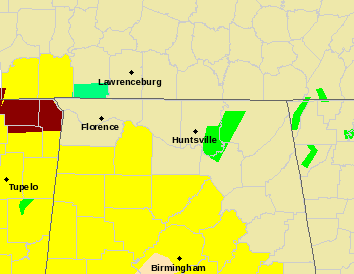
- Tornado Watch
The National Weather Service has placed Cullman County and much of Alabama under a tornado watch until 7 p.m. as another round of storms begins to enter the area.
According to the NWS, scattered supercell thunderstorms are expected again this afternoon, as the atmosphere will become progressively unstable in the wake of the northward- moving warm front. Although storm coverage will be scattered, damaging winds, large hail and tornadoes will be possible.
The main threat area will be for strong to severe storms will be for locations to the south and west of Huntsville.
A third and more widespread threat for severe thunderstorms will develop ahead of an eastward-moving cold front by late this afternoon, and persist throughout the evening and into early morning hours on Thursday. Strong, long-track tornadoes, significant damaging winds and large hail will all be possible, until the front clears the region shortly before sunrise on Thursday morning.
In addition to the threat for severe thunderstorms, multiple rounds of locally heavy rainfall will lead to an enhanced risk for flash flooding today and tonight, as well as river flooding that may persist through the end of the week.