County braces for prolonged bitter cold snap arriving late Saturday
Published 5:01 pm Friday, January 17, 2025

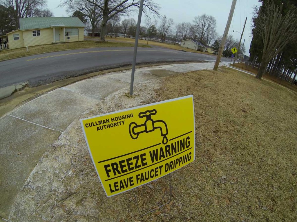
- A sign reminds people to keep a bit of water running to prevent pipes from freezing is seen in Feb. 2015.
Saturday and Sunday will seem like days from different seasons this weekend, as Arctic air arrives to put a dramatic chill on Saturday’s mild and rainy daytime weather.
The arrival overnight Saturday of an extremely cold air mass will begin a protracted period of dangerously frigid temperatures in north Alabama, extending at least into the latter part of the upcoming week. Between Sunday and Wednesday, daytime high temperatures are not expected to climb out of the mid-30s; on Monday and Tuesday, forecasters anticipate daytime highs only in the 20s.
Nighttime temperatures during the extended cold snap will be even harsher, sinking into the teens or even the high single digits in some areas — with winds on Sunday evening, ushered in by a fast-moving “clipper” system out of Canada — making outdoor temperatures feel as if they’re near or below zero degrees.
The Huntsville office of the National Weather Service currently expects little or no wintry precipitation for the Cullman area as temperatures begin to fall during Saturday’s rain event, and only slight chances for additional precipitation once the cold sets in through Tuesday and Wednesday. But a separate storm system — still too distant to accurately forecast — may bring another chance for snow, sleet, or freezing rain in the wake of a slight warming trend (with daytime highs rising into the 40s) near the end of next week.
With temperatures failing to eclipse the freezing mark for perhaps a 72-hour period or longer, cold weather hazards present the greatest safety risks associated with the inbound Arctic air. NWS advises north Alabama residents to take steps now to protect water pipes, make indoor accommodations for outdoor plants and animals, and establish a way to check on elderly or vulnerable loved ones. Those who use space heaters inside their homes should also ensure that power cords are intact and unobstructed, while maintaining a 3′ radius of uncluttered space around each heating device.
Those who work outdoors during the cold snap also should limit their exposure, while remaining aware of the indications of frostbite and hypothermia. Dress warmly in layers and cover exposed skin if you do plan to spend time outside.
“People exposed to extreme cold are susceptible to frostbite and can succumb to hypothermia in a matter of minutes,” NWS states: “Areas most prone to frostbite are uncovered skin and the extremities, such as hands and feet. Hypothermia occurs when the body loses heat faster than it can produce it.”
In addition to monitoring its social media feed on Facebook, the Cullman Emergency Management Agency (EMA) advises Cullman County residents to download the Everbridge public safety app to their mobile devices to receive tailored, real-time alerts about weather, road conditions, and emergency notifications. The Everbridge app is available for both Apple iOS and Android devices through the Apple App Store and Google Play.
EMA, in partnership with the Cullman County Voluntary Organizations Active in Disaster (VOAD), will share via social media the opening schedules for local warming stations in Cullman, Hanceville, Fairview, Vinemont, and Dodge City as the cold approaches, with information continually updating on the agencies’ social media platforms.
Follow Cullman County VOAD on Facebook (https://www.facebook.com/CullmanCountyVOAD/) for current information about warming shelter locations, as well as each shelter’s operating policies. Follow the Cullman County EMA on Facebook (https://www.facebook.com/CullmanCountyEMA/) also for shelter information, as well as current weather-related alerts for Cullman County.


