Zeta set to bring wind, rain ahead of crisp fall weather
Published 5:00 am Wednesday, October 28, 2020

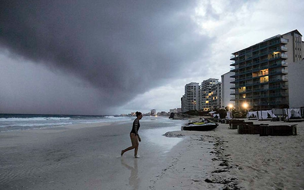
- Clouds gather over Playa Gaviota Azul as Tropical Storm Zeta approaches Cancun, Mexico, Monday, Oct. 26, 2020. A strengthening Tropical Storm Zeta is expected to become a hurricane Monday as it heads toward the eastern end of Mexico's resort-dotted Yucatan Peninsula and then likely move on for a possible landfall on the central U.S. Gulf Coast at midweek.
Yet another tropical system is churning toward Alabama as Zeta — the 27th named storm of the 2020 hurricane season — makes its way toward a Gulf Coast landfall later today. But even though the system is currently on track to affect Cullman County as it heads through the state, forecasters are expecting mostly just a good soaking for our area, with some potential for wind gusts and localized flooding.
Zeta is expected to be at Category 1 hurricane strength by the time it makes landfall somewhere in the vicinity of New Orleans late this afternoon. From there, the storm is set to weaken as it moves northeast through Mississippi and into Alabama. Gov. Kay Ivey on Tuesday declared a state of emergency ahead of the still-potent system’s first arrival in the state’s southern counties.
Current NWS forecasts have Zeta on track to scrape Cullman County as the core of the storm moves from west to east, threatening more severe weather for Jefferson County and areas farther south along a track that places the brunt of its severity along a path stretching from Demopolis to Anniston. But the system’s outer bands will bring plenty of local rain and straight-line winds, according to Cullman County Emergency Management Agency director Phyllis Little.
“We’re not under any kind of alerts here, though that could change,” Little said Tuesday afternoon. “There’s a possibility we could see some drainage issues and some flash flooding, in general areas where we commonly have those kind of problems. But unless something changes, we’re not looking for any significant severe weather here.
“The counties to our south, from Jefferson and other places covered by the Birmingham National Weather Service office are under a tropical storm watch,” she added. “But for our area, we’re mainly expecting two to three inches of rain by the time it’s over, and gusty winds.”
If Zeta does spawn severe weather that affects Cullman County, Little said it’s likely to be to the south and east. “There may be more rain, and possibly some heavier stuff, from the southern end of the county up through the northeast part,” she explained. “If you were to draw a line from Bremen across to Joppa, anything to the south and east of that could see higher chances.”
Rain from Zeta’s outer bands will fall throughout the day today in Cullman County, elevating during the evening and overnight hours before beginning to clear on Thursday. Behind the system, said Little, is a mass of much cooler air that’ll usher in clear skies and more seasonal weather for the weekend.
“The showers on Thursday will be mainly before lunchtime, and we’re looking at a high temperature of 74 on Thursday,” she said. “Then, it’s going to turn cool. There’s a forecast low of 46 degrees for Thursday night, and the high on Friday is only going to be 52, with sunny and clear weather. It should end up being perfect kind of weather for watching football.”


